Popular destinations nearby
Balatonfüred,
Hévíz,
Siófok,
Veszprém,
Zalakaros,
Badacsonytomaj,
Keszthely,
Tihany,
Fonyód,
Nagyvázsony,
Sümeg,
Szigliget,
Tapolca,
Zamárdi,
Zánka
|
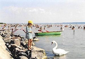
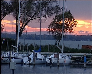
Gyenesdiás is situated on the shore of Balaton in Zala county, in the western Balaton region, at the foot of Keszthely mountains. The eastern edge of the village is completely built together with Vonyarcvashegy, and its western edge reached the border of Keszthely. The village of 3.000 inhabitants was developed on the territory of three former villages, after the Turkish rule. Two villages (Falud and Diás) were depopulated in course of the destructions, only their vineyards lived further on. Laws of Diás Vine-growing community regulating viniculture in the region was published in 1653. It was one of the first laws of this kind in Europe. It was in force until 1949. The village received the name Gyenesdiás in 1840. At that time there were some smaller mills and a stone-mine belonging to the village. At the beginning of the century there were two bathing associations established in the village and their activity created the bases of tourism here. Historic monuments of the village are the Classicist St. Ilona chapel built in 1826 and the Havas Boldogasszony church of Diás (1893). A few wine cellars built in the 13th century also remained in the village. In the renovated Shepherds' House in the neighbourhood of the St. Ilona chapel there is an exhibition on the history of Gyenesdiás. Lodgings in Gyenesdiás: Pictures of Gyenesdiás
|
Gyenesdiás map nagyítása >>
|
|
|
Hungary - Gyenesdiás |
|
|
|
||
|
Monday, 23. March 2026. - 11:21:01 |
||