Popular destinations nearby
Balatonfüred,
Hévíz,
Siófok,
Veszprém,
Zalakaros,
Badacsonytomaj,
Keszthely,
Tihany,
Fonyód,
Nagyvázsony,
Sümeg,
Szigliget,
Tapolca,
Zamárdi,
Zánka
|
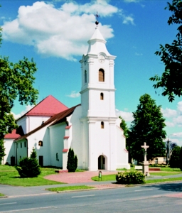
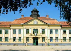
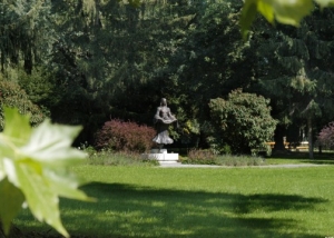
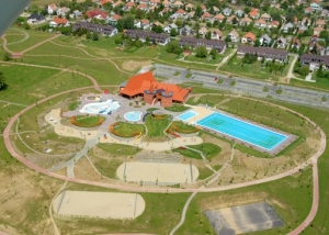
Town with 13,000 inhabitants 13 km south of Balatonkeresztúr. It is surrounded by the 300 m high wooded hills of Marcali ridge from the west, and lowlands varied with lakes and gallery forests from the other sides. The village surviving the Turkish rule with only 150 inhabitants, was quickly rebuilt in the 18th century as an estate of the Széchenyi family; the assemblies of Somogy county were held in the village from 1735 till 1749. Marcali was granted the privileges of an agricultural town in 1772. In World War II the village became part of Margit line built by the Germans, 10% of the inhabitants fell victim to the fights. In 1977 Marcali was declared a town; it is a trading, sanitary and cultural centre of the area. Roman Catholic church in the centre is of 15th century origin, rebuilt with Baroque and neo-Classic stylistical characteristics. The former Széchenyi mansion, built in neo-Baroque style in 1913, is now used as a hospital. Unique architectural values of the town include the buildings of the town court and the town hall, too. Exhibitions of the Local History Museum: "Finishing of hemp" and "Viniculture and wine-growing in the area of Marcali". Beyond the works of the famous painter, Aurél Bernáth, born in the town, temporary exhibitions are also open for visitors in the Bernáth Gallery. Significance of the town is also increased by its advanced trading activity, attractive not only for the inhabitants of the surrounding settlements but also for the guests of Lake Balaton. Pictures of Marcali
|
Marcali map nagyítása >>
|
|
|
Hungary - Marcali |
|
|
|
||
|
Wednesday, 29. July 2026. - 01:21:22 |
||